
UN General Assembly Votes to Promote Equal Earth Projection for More Accurate World Maps
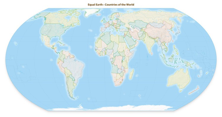
The United Nations General Assembly has voted to promote the use of world map projections that more accurately represent the relative size of continents. The resolution was presented during a session at the UN headquarters in New York on September 4 and received 164 votes in favor, with one country voting against and six abstaining. Sponsored by Togo, the resolution encourages governments, educational institutions, international organizations, and technology companies to use equal-area projections when geographic scale is relevant. The resolution does not formally replace or prohibit the use of the Mercator projection, which has been widely used since the 16th century. Instead, it calls for greater use of projections that preserve the relative area of landmasses and encourages education about the limitations of representing the Earth's curved surface on a two-dimensional map. The 2018 Equal Earth projection is identified as one example of a map that more accurately represents continental scale.
The United Nations General Assembly has voted to promote the use of world map projections that more accurately represent the relative size of continents. The resolution was presented during a session at the UN headquarters in New York on September 4 and received 164 votes in favor, with one country voting against and six abstaining. Sponsored by Togo, the resolution encourages governments, educational institutions, international organizations, and technology companies to use equal-area projections when geographic scale is relevant. The resolution does not formally replace or prohibit the use of the Mercator projection, which has been widely used since the 16th century. Instead, it calls for greater use of projections that preserve the relative area of landmasses and encourages education about the limitations of representing the Earth's curved surface on a two-dimensional map. The 2018 Equal Earth projection is identified as one example of a map that more accurately represents continental scale.